WALKS
Here are descriptions of walks we have completed between the villages. We set off each time properly clothed with a bottle of water and a map in case we got lost! You might want to follow in our footsteps but don't blame us if something goes wrong!
INDEX:
WALK 1: Whatton; Orston; Thoroton; Aslockton and Whatton (5 miles+)
WALK 2: Car Colston: Screveton and Car Colston (3 miles)
WALK 3: Flintham: Syerston; Elston; Sibthorpe and Flintham (5 miles)
WALK 4: Cropwell Bishop; Cropwell Butler and Cropwell Bishop (4 miles)
WALK 5: Wysall to Willoughby-on-the Wolds and back to Wysall (4 miles)
1. Whatton, Orston, Thoroton, Aslockton and Whatton
Walk completed 25th June 2015.
The route we followed was Walk 38 in '100 Walks in Nottinghamshire' compiled by Malcolm Sales. The book is eighteen years old but footpaths don't change much so we didn't think there would be any problems ... how wrong we were!
As instructed we parked on Conery Lane next to The Green in Whatton, right outside Whatton Hall. We were instructed to walk down Orston Lane next to The Griffin pub. The problem was the pub has gone! Across the road was a public display board containing a map so we were able to find the lane without the pub.
We followed Orston Lane for about 50 yards then the tarmac ended and the lane became a delightful farm track bordered by overgrown hedges, tall grasses and wild flowers.
There were Dunnocks, Whitethroats and Yellowhammers aplenty and we spotted a Painted Lady, Brimstone, Speckled Wood, Red Admiral and Large Skipper butterflies and a Chimney Sweeper and Silver Y moth along the way.
 |
| Painted Lady butterfly |
 |
| Chimney Sweeper moth |
We paused next to the River Whipling and found Blackcaps and Reed Buntings. Skylarks and Chiffchaffs were singing all around us while Swallows hunted above.

We continued along for a mile until we reached a field with two huge tree stumps. The number of rings suggested the trees had been quite ancient when felled. Odd to think of all those passing years and people.
 |
| 'Dragonfly Pond' |
Turning right along the edge of the field and then left we followed the field edge until a clearly marked public footpath came into view on our right. The path took us through the hedge then turned left (northwards) going towards the railway line. Just before Bridge 23 we stopped at a small reed lined pond on the right. A large Emperor Dragonfly traced the surface, Four Spotted Chasers and Common Blue Damselflies competed with Banded Demoiselles for our attention. It was a lovely place to rest for a few pleasant minutes.
 |
| Emperor Dragonfly |
 |
| Four Spotted Chaser |
Under the railway line .....
 |
| Railway Bridge 23 |
..... we turned right passed fields of wild flowers: Red Campion, blue Campanula and purple Cornflowers with delicate tall grasses. The path lead through a small copse then the book told us to take an optional detour to the right to visit another small pond but the way was barred by a large green fence. A sign informed us that this was Orston Plaster Pits; a Site of Special Scientific Interest (SSSI). The area provides "one of the best examples of species rich in neutral and calcareous grassland meadows in Nottinghamshire". There was a pond on the left filled with yellow iris so we visited that one instead!
The path becomes a track (Moor Lane) and we followed it into Orston.
 |
| Pretty cottage, Orston |
We came out on Hill Road eventually turning left onto Loughbon (following signs to Scarrington and Car Colston). Loughbon became The Green. Here there is a nice country café with seats in the sunshine if you feel in need of refreshment or The Durham Ox pub has a pleasant garden area if you fancy a pint. Continuing along The Green we passed the church on the right then turned right next to this unusual phone box, to walk along High Street.
 |
| Orston phone box in use! |
 |
| Yellow Wagtail |
On the way we caught some lovely distant views of red brick buildings hiding amongst trees and Hawksworth church tower just peeping through the canopy. Picture postcard Notts.
 |
| Hawksworth village |
We continued to the village road in Thoroton, where we turned left and 50 yards later turned right onto a clearly sign posted bridleway. The bridleway runs north west-wards crossing several fields to eventually end at Old Glebe Farm, Hawksworth. At one point it was not clear which way to go - we had hit a T junction with no sign posts. We chose to go left then took a right and found the farm.

On the approach to Old Glebe Farm we got clear views of a Red Kite circling the fields. They are not a very common sight in Nottinghamshire, although the number of sightings has increased over the last few years as a result of a spectacularly successful reintroduction programme.
 |
| Red Kite |
A couple of Common Buzzards and a Kestrel were added to the bird list too.
 |
| Common Buzzard |
At this point in the walk the book directions didn't match what we could see in front of us. The book said to turn sharp left southwards following a path across more fields heading towards Aslockton. Looking left there was an obvious gate but there was no obvious path! On the other side of an overgrown grass field were 2 stiles each clearly marked with yellow directional arrows. However the first one pointed back due East towards Thoroton where we had just come from, and the second one lead us more or less to the Hawksworth /Scarrington Road. Rather than wander through fields and getting lost we decided to follow the road towards Scarrington (so we left the fields and turned left). We paused at the sound of a Green Woodpecker calling and found two juvenile birds sitting in a tree a short distance away. A few minutes later we turned left (just before Scarrington Old Vicarage) onto Long Moor Lane. A couple of hundred yards along the road the footpath we should have taken crossed the road. So we turned right to rejoin the correct path, which was now very clear, heading towards Aslockton.
 |
| Aslockton |
The path ended at Mill Lane where we turned left and after 10 yards we turned right along Chapel Lane, at the end of which we turned left along a small alleyway which took us to the main road in Aslockton.
We turned right and walked passed the church and Cranmer's Cottage until we came to a clearly marked footpath on the left (directly across the road from Abbey Lane). This took us across the railway line, through a meadow and across the River Smite. Once over the Smite Whatton village is surrounded by animals: sheep were sheltering in the shade of the trees, a colourful cockrel watched us go by, pigs ignored us and horses walked over looking for affection. The path enters Whatton near the Church of St John of Beverley. We followed Church Street back to Conery Lane and the car.
 |
| Whatton |
Bird List:
Blackbird, Blackcap, Blue Tit, Bullfinch, Common Buzzard, Carrion Crow, Chaffinch, Chiffchaff, Collared Dove, Dunnock, Goldfinch, Great Tit, Greenfinch, Green Woodpecker, Grey Wagtail, House Martin, House Sparrow, Jackdaw, Kestrel, Lapwing, Lesser Black-backed Gull, Linnet, Long-tailed Tit, Magpie, Moorhen, Pheasant, Pied Wagtail, Red Kite, Reed Bunting, Robin, Skylark, Song Thrush, Starling, Stock Dove, Swallow, Swift, Common Whitethroat, Willow Warbler, Wood Pigeon, Wren, Yellowhammer, Yellow Wagtail.
Butterflies & Moths:
Brimstone, Chimney Sweeper, Common Blue, Large Skipper, Large White, Meadow Brown, Painted Lady, Red Admiral, Silver Y, Speckled Wood.
2. Car Colston to Screveton to Car Colston
 |
| Car Colston Village Green |
This is an easy, flat walk covering about 3 miles (it took us two and a half hours bird watching along the way). Walk completed early July 2015.
 |
| Car Colston Cricket Pavilion beyond the Village Green |
We parked in the Royal Oak car park in Car Colson with thoughts of the refreshing beverages awaiting us on our return we walked away from the pub (with the cricket pavilion behind us) and headed over a small wooden bridge towards the footpath sign next to Farrier's Cottage. Here we turned right and followed the farm track in a South Easterly direction.

There were picturesque glimpses of red brick houses among the trees and a kestrel circling the field as we looked back. The track ended at a kissing gate which we passed through and immediately turned left to go over a stile.
 |
| Brown Hare |
We walked along the edge of this field, surprising a couple of red-legged partridges and causing a brown hare to attempt the land speed record. We crossed over the track at the end of the field and passed through another kissing gate. Moths and butterflies fill the meadows at this time of year so we paused for a few minutes before walking to the triple stile at the other side of this field. The path ran in a straight line across another couple of fields/paddocks until it reached a stile in the hedge onto the Scarrington Road. Make sure each gate is firmly closed.
 |
| Gatekeeper |
Cross the road and re-join the footpath (clearly signed). Walk straight ahead (North Easterly direction), through the gap in the hedge follow the clear path through two more fields (taking care not to damage the crops) then across the wooden bridge next to the yellow way marker. We walked towards some houses as we passed through this next field pausing for a moment to listen to the bees ... they were buzzing so loudly as they fed on the clover. The path continues straight until you come to a double gate. There are houses to the left of the field but we turned right, following the field edge in an Easterly direction, making for the top corner (away from the houses). We went through a double gate, passed a lovely horse chestnut tree, following the path to a kissing gate on the right. Through this then turn left passing the back of a large farm building to a footpath sign and an old iron gate.

Through the gate to join the farm track, continuing straight ahead to the main Hawksworth Road where we turned left to enter the village of Screveton. We followed the road and turned left at the junction (signed for Car Colston). Opposite Lodge Lane there is a bus stop shelter with a clearly marked footpath leading to the left. We followed the path back into a field we crossed earlier. This time we turned right and followed the field edge keeping the dry ditch to our right until we reached a double gate through the hedge. We continued straight until we reached St Wilfrid's Church. Passing through the church yard, out of the gate onto a gravel path we turned left then right onto the road and left again towards Car Colston.
 |
| St Wilfrid's Church |
Here we could follow the road back to the Royal Oak but we turned off left opposite Brunsell Hall, joining a clearly marked foot path The path crosses a wooden bridge and goes towards some white cottages. We crossed a track and found a gate in the hedge next to the right hand side of the white house (Hollin's Cottage). Straight ahead is the church, the path follows a red brick wall aiming for the church. Over the stile, we kept to the field edge until another stile on the right took us into the church yard. Here we stopped to look for Little Owls that roost in the trees at the field edge. This time we didn't find Little Owl but we saw a Spotted Flycatcher so it wasn't a total waste of time.

We left the church yard through a gate, turned left keeping the cottage on our right then turned right immediately after the cottage. This was obviously the old path from Car Colston village to the church. It ends at the old village stocks! The village green is directly in front and the road to the right goes back to the pub and the anticipated refreshments.

Bird list:
Blackbird; Black Headed Gull; Carrion Crow; Chiffchaff; Collard Dove; Goldfinch; Great Tit; Great Spotted Woodpecker; Greenfinch; Green Woodpecker; House Martin: House Sparrow; Jackdaw; Kestrel; Red legged Partridge; Robin; Song Thrush; Spotted Flycatcher; Starling; Swallow; Swift; Wood Pigeon; Yellow Hammer.
Butterflies & Moths:
Gatekeeper; Large White; Meadow Brown; Small Tortoiseshell.
3. Flintham: Syerston; Elston; Sibthorpe and Flintham
The walk is Number 12 Flintham in Pub Walks in Nottinghamshire by A Bristow, N James, C Robson and M Smith.
A lovely flat, easy walk covering about 5 miles. It took us 3 hours at a gentle stroll.
Our walk was completed 21st July 2015.
The walk begins (and ends) at the Boot and Shoe public house.
 |
| Dead magpies - Syerston |
The road took us left and continued on to a junction next to Montague House with a view of the church to our left. We turned right here and about 100 yards later we saw a footpath sign on the left (across the road from a phonebox library).
 |
| Syerston / Elston footpath |
 The footpath took us down a tree tunnel and over a stream into a field. We turned left and followed the path around the edge of the field. The path continued until it reached a sign post on a sort of cross road (cross path?). Anyway we took the left path towards Elston. There were fine views of Eden Spa (or Elston Towers as it was originally named) to our left. This is a truly fascinating building originally built for Richard Middleton of Newark. He was a lay preacher and the design of the house incorporated a large chapel and baptismal tank.
  |
| Eden Spa |
After passing through the gate onto the road and we turned right towards Elston. The large house on the right, Elston Hall, used to belong to the family of Charles Darwin (his grandfather was born there).
 |
| Elston Hall |
 The road took us passed Ann Darwin's cottage (alms house) on the right then the Rectory and the church on our left then it a bends to the right at the junction of Toad Lane (next to The Chequers public house and the site of the Fun Fair Brewery). The pub only opens Thursday to Sunday evenings so we couldn't sample their brews but we do intend to go back! On leaving the village we walked for about half a mile when we took a signed right hand turning towards Sibthorpe. At Sibthorpe we took another signed right hand lane next to the old forge towards Flintham. We could have walked into the village itself .... there is a large old dovecote that you can see from the road .... but the weather was closing in so we followed the road. After taking a final right hand turn we passed the old pinfold and returned to the Boot and Shoe.

Bird list:
Blackbird; Blue Tit; Bullfinch; Carrion Crow; Chaffinch; Chiffchaff; Collard Dove; Cormorant; Dunnock; Greenfinch; Goldfinch; House Martin; Jackdaw; Lesser Black-backed Gull; Linnet; Long-tailed Tit; Magpie; Mistle Thrush; Pheasant; Reed Bunting; Robin; Rook; Skylark; Sparrowhawk; Starling; Stock Dove; Swallow; Swift; Wood Pigeon; Wren; Yellowhammer.
Butterflies & Moths:
Comma; Gatekeeper; Meadow Brown; Peacock; Ringlet; Small Skipper; Small Tortoiseshell; Small White
4. Cropwell Bishop; Cropwell Butler and Cropwell Bishop
A flat, easy walk of about 4 miles (6.3 kms) that took us a couple of hours to complete (could have been longer but the pubs were closed!).
Steps: 8000 + Calories: 720
We completed the walk on 29th May 2016.

We parked in the carpark opposite the Wheatsheaf in Cropwell Bishop then turned right to walk up the main road away from the church. We passed the Methodist Chapel on the left and the Cheese factory on the right before arriving at the Public Footpath opposite Kinoulton Road. The path goes passed the children's playground (on your left) and into the fields.

One of the fields has quite distinct ridges (which looked like evidence of strip farming?) and in late May it was covered in bright buttercups. Crows, wood pigeons and starlings were feeding along with a couple of horses. You can enjoy the view of Hoe Hill and the woods as you walk along the path.

Keep to the right hand side of the field to pass through a wooden gate at the end. Go straight ahead, ignoring the left hand footpath. Hoe Hill is now on your left.
Straight ahead again to go through a second wooden gate. It is a well used path bordered by lovely wild flowers at this time of the year.

Go straight over at the cross road and up the slight incline. Ignore the left hand footpath to go straight ahead looking for a well marked wooden 'kissing-gate' on the right.

Through the gate then turn left onto a diagonal path that takes you straight towards the modern houses on the edge of Cropwell Butler.
Go through the stile to enter Cropwell Butler, turn right then follow the road down the hill keeping the post box and the road salt box on your right hand side. This will take you to Main Street. Keep straight ahead passed The Plough public house .... but only if you want to!

There are lovely houses and gardens along the road as you walk towards the village green where you will find the old village pump.

Turn left up the road, passed Back Lane, passed the white thatched house ....

.... passed The Lodge with the two dragons on the roof, up to The Old Police House. Cross the road to the Public Footpath signs. There are two signs: you want the bridle path on the left so go through the gate and turn left! This took us through lovely wild flower meadows ... but strangely there were no butterflies.

At the end of the field the gate takes you onto the road ...

.... go through the gate and turn right then immediately turn left onto the bridle path. Walk up the slight hill then down towards the kissing gate you went through earlier. (Don't go through it again!...) follow the path passed a right hand footpath; over the cross road again; up a slight hill to a second right hand path. This is marked with a black arrow and is called the 'Notts Wolds Way'. Take this right hand path. Hoe Hill is now on your left.
Go into Hoe Wood keeping right onto the main path. Look out for Long-tailed tits, Goldcrests and other woodland birds.

At the wood edge turn right, keeping the wood on your right, up a slight hill to a metal stile, go through, turn left then immediately turn left again. Do NOT go over the disused canal. Keep the dry canal on your right as you walk down the Notts Wolds Way which is the old canal tow path.

Such a shame the canal is dry and overgrown when it was once such a busy route.
Keep to this path now. It is signed Notts Wolds Way. Keep right at the next junction (do not go through the metal gate), keep the canal on your right as you go through the next field, through a metal gate and back to the ridged field you passed earlier.

Go over a wooden stile, through the field then cut through a gap in the hedge towards the children's playground.

The path takes you back to the main road in Cropwell Bishop, turn left passed the Memorial Hall to return to the Wheatsheaf public house.

Bird List
Blackbird, Blackcap, Blue Tit, Buzzard, Carrion Crow, Chaffinch, Chiffchaff, Collard Dove, Dunnock, Goldcrest, Goldfinch, Great Spotted Woodpecker. Great Tit, Greenfinch, Greylag Goose, House Martin, House Sparrow, Jackdaw, Jay, Linnet, Long Tailed Tit, Magpie, Pheasant, Robin, Rook, Skylark, Starling, Swallow, Swift, Willow Warbler, Whitethroat, Wood pigeon, Wren and Yellow Hammer.
5. WYSALL TO WILLOUGHBY-ON-THE WOLDS AND BACK TO WYSALL
Walk completed 3rd April 2017
 |
| Wysall Village Spring Flowers |
This is a pleasant, easy walk but you might need wellies in winter as we found it a little wet when we completed it in Spring.

The walk begins in Wysall village. We followed the signed footpath next to the Village Hall across from the church. This takes you through a children's play area. You might want to pause for a few minutes to try out some of the adult exercise equipment!
 |
| May in April! |
Follow the path (signposted in yellow) over a stream then across fields and a couple of stiles. It is very well marked so difficult to go wrong.

You will go over three bridges before you reach the bridge over the Kingston Brook.

Cross over this fourth bridge then turn left at the small wooded area. The path follows the edge of a field but then kinks a few times .... all very well marked by the yellow signs.
 |
| Yellow Hammer |
Go between Thorpe Lodge Farm and a wood. Walk uphill across a field, over a stile then follow the hedgerow to another small bridge. Over the bridge then turn right, over the field to a lane.
 |
| Lane at West Thorpe |
Cross the lane listening for the woodpeckers if you go at the right time of year. Continue over a few fields towards Willoughby.
 |
| Celandines |
NOW WATCH THE SIGNS CAREFULLY .... you can chose to make the walklonger here if you continue into Willoughby (but be warned the pub is closed!) but then you would need to retrace your footsteps back to here OR you can turn right through a gate next to an electric pylon (on your left with a stream on your right) walking away from Willoughby on the Wolds .... this route is signposted in yellow as the Notts Wold Way.
 |
| Rookery |
Follow the sign path over a couple of fields then over a brick bridge. Go through more field until you reach the small triangular shaped wood. Go through a gate then follow the field path with the wood on your left.
 |
| Friendly cows .... well, they frightened me a little bit! |
At the end of the wood go through a gap in the hedge and turn right. Walk along the hedge under a line of telegraph poles towards another wood.
 |
| Friendly horse! |
Go over a stile into another field follow the path and telegraph poles. Keep left of the farmhouse and stay with the telegraph poles, through a stile and contuinue until you reach another stile taking you into another field.
 |
| Aloof Alpacas! |
 |
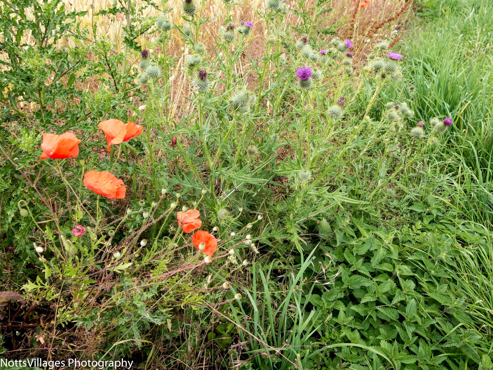
| Watch out for some unusual wild flowers |
Bird List:
Blackbird, Blue Tit, Buzzard, Carrion Crow, Chaffinch, Chiffchaff, Collared Dove,Dunnock, Goldfinch, Great Tit, Great Spotted Woodpecker, Green Woodpecker, House Sparrow, Jackdaw, Kestrel, Linnets, Long Tailed Tit, Magpie, Mallard, Mistle Thrush, Pheasant, Red legged Partridge, Robin, Rooks, Skylark, Song Thrush,Stock Dove, Wheatear, Wood Pigeon, Wren, Yellow Hammer
This was a really disappointing walk this morning due to difficulty in seeing the signposts hidden behind piles of rubbish, we ended up backtracking more than once. We walked through the most disgusting farm/industrial area at Thorpe in the Glebe with rubbish dumped everywhere. Concrete, plastic, metal, builders rubble, even childs toys, old piping etc. All dumped in the fields to stay for eternity. Not enjoyable.
ReplyDeleteMy comments are with regards to the walk from Wysall to Willoughby
ReplyDelete